Bargate plans Dorset homes: layout, green space and density notes for designers
Reviewed by Joe Ashwell
First reported on The Construction Index
30 Second Briefing
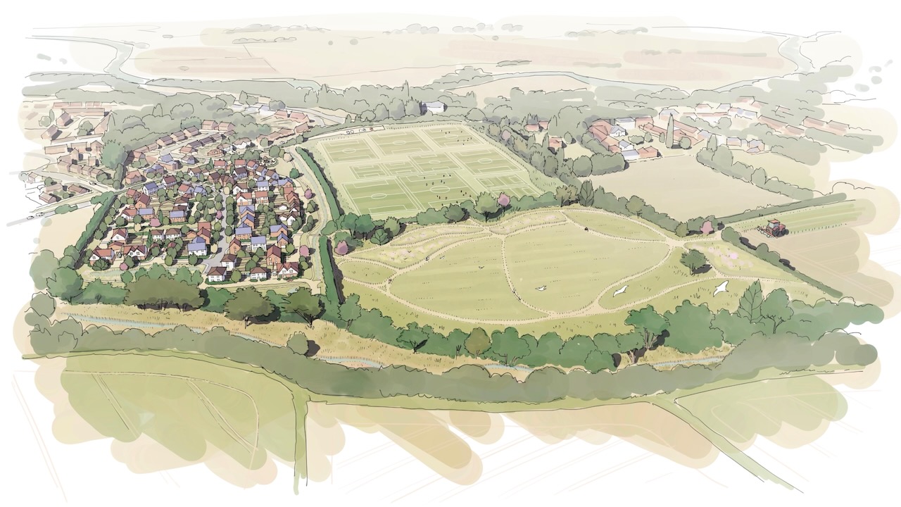
Bargate has lodged outline plans with Bournemouth, Christchurch and Poole Council for up to 100 one- and two-storey homes north of Salisbury Road in Burton, with 50% designated as affordable housing and development concentrated on the southern field. The western Winkton Fields parcel is retained as playing fields and the eastern parcel is proposed as green space, forming part of a landscape strategy that includes Suitable Alternative Natural Greenspace (SANG) and formal and informal play areas. Masterplanner Mosaic and planning consultancy tor&co have set flexible design parameters to respect Winkton Conservation Area and manage the village–countryside transition.
Technical Brief
- Development parameters allow up to 100 units without fixing a detailed masterplan layout.
- Dwelling heights are limited to one and two storeys to align with existing village grain.
- Plot orientation is being tuned to maximise easterly views over the rural edge.
- Suitable Alternative Natural Greenspace (SANG) is embedded in the landscape strategy to offset recreational pressure on protected habitats.
Our Take
Within our 936-item Infrastructure corpus, relatively few schemes in southern England combine a 100-home scale with a 50% affordable allocation, signalling that Bargate’s Burton proposal is at the more interventionist end of local housing-mix policy and likely to face close viability scrutiny.
Schemes in Dorset and neighbouring Hampshire in our database that sit adjacent to conservation areas, like Winkton Conservation Area here, typically see elongated planning timelines and heavier landscape-led design requirements, so Bargate’s early emphasis on landscape strategy is likely a risk-management move rather than pure placemaking.
Being selected as preferred development partner from 2025 positions Bargate alongside other regional housebuilders in our coverage that are increasingly working under council-led frameworks, which tends to lock in tighter sustainability and design codes but can offer more predictable pipeline than purely speculative land plays.
Prepared by collating external sources, AI-assisted tools, and Geomechanics.io’s proprietary mining database, then reviewed for technical accuracy & edited by our geotechnical team.
Related Articles


Related Industries & Products
Mining
Geotechnical software solutions for mining operations including CMRR analysis, hydrogeological testing, and data management.
Construction
Quality control software for construction companies with material testing, batch tracking, and compliance management.
CMRR-io
Streamline coal mine roof stability assessments with our cloud-based CMRR software featuring automated calculations, multi-scenario analysis, and collaborative workflows.
HYDROGEO-io
Comprehensive hydrogeological testing platform for managing, analysing, and reporting on packer tests, lugeon values, and hydraulic conductivity assessments.
GEODB-io
Centralised geotechnical data management solution for storing, accessing, and analysing all your site investigation and material testing data.