American Rare Earths boosts Mineral Resource Estimate for Cowboy State mine
First reported on MINING.com
30 Second Briefing
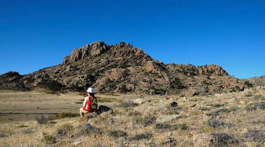
American Rare Earths has lifted the Cowboy State mine Mineral Resource Estimate within the Halleck Creek project in Wyoming to about 547.5 million tonnes at a 1,000 ppm TREO cut-off, following 18 additional channel samples and expanded geological mapping. Around 63.9 million tonnes have been upgraded from inferred to indicated, and 27 in-fill drill hole locations have been permitted by the Wyoming Department of Environmental Quality to support a forthcoming prefeasibility study and later technical work. The project also benefits from up to $7.1 million in state-backed, non-dilutive funding secured in 2024.
Technical Brief
- Additional geological mapping tied to the channel sampling expanded the defined CSM resource footprint, adding ~4.5 Mt to the mineral resource without new drilling.
- In-fill drilling will be critical for tightening geological continuity, improving variography and enabling more robust geotechnical and hydrogeological characterisation across the CSM pit shells.
- For other US rare earth projects, the CSM pathway illustrates how relatively low-cost channel sampling and mapping, combined with targeted permitting for in-fill drilling, can incrementally de-risk resources ahead of major capex commitments.
Context From Recent Coverage
- With a 547.5 Mt rare earths resource in Wyoming and a sub-US$200m market capitalisation, American Rare Earths sits in the group of juniors in our database where in-situ resource scale significantly outpaces current balance-sheet strength, which often precedes JV or strategic offtake discussions once metallurgy and permitting are de-risked.
- State-backed, non-dilutive funding of US$7.1m alongside drilling permits from the Wyoming Department of Environmental Quality signals that US regional authorities are actively underwriting early-stage critical minerals work, which can shorten the typical lag between resource definition and a construction decision compared with similar-scale projects in more restrictive US jurisdictions.
- The 27 permitted drill-hole locations at the Cowboy State mine area, following only a modest resource tonnage uplift from mapping and channel sampling, suggest ARR is now pivoting from footprint definition to confidence upgrading, a pattern in our coverage that usually precedes a more detailed PFS-style study rather than further step-out exploration.
Related Articles


Related Industries & Products
Mining
Geotechnical software solutions for mining operations including CMRR analysis, hydrogeological testing, and data management.
Construction
Quality control software for construction companies with material testing, batch tracking, and compliance management.
CMRR-io
Streamline coal mine roof stability assessments with our cloud-based CMRR software featuring automated calculations, multi-scenario analysis, and collaborative workflows.
HYDROGEO-io
Comprehensive hydrogeological testing platform for managing, analysing, and reporting on packer tests, lugeon values, and hydraulic conductivity assessments.
GEODB-io
Centralised geotechnical data management solution for storing, accessing, and analysing all your site investigation and material testing data.